|

|

|

|

|

|

|

|

|

|

|

|

|

|

|

|

|

|

|

|

|

|

|
The Chianti Castles routeLa Strada dei Castelli del Chianti |
|

|
Orange Itinerary - Campi, San Sano, Monteluco di Lecchi, San Polo in Rosso, Galenda, Le Selve |
|

|

Monteluco di Lecchi |

|
When you arrive at km 19 of the main road (s.s. - strada statale - 408), you will see an upward-sloping turnoff which you take. After a short distance, you take the road to San Sano, on the left, from which Campi can be reached after another short stretch. This place is mentioned as a castle in the middle of the 11 C. In the following century, it became a property of the Mazzalombardi family from whom it was seized in 1167 as a reprisal by the Emperor Frederick I, who gave it to the Ricasoli family. This concession was confirmed by subsequent emperors. All that remains of the castle are some ruins protruding from the ground, with the sole exception of a small, truncated stone tower. |
|

|

|

|
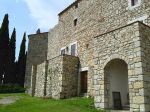
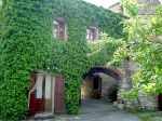
The road ends a little further on in San Sano, a mediaeval village, which shows no trace of fortifications but rather is made up of several stone buildings in Romanesque style, among which is a taller and bigger building, which could have been a keep. San Sano seems not to be mentioned in any documents, with the exception of its church, which appears in the lists of the papal tithes for year 1276-1277. |

|

San Sano |
|

|
|
Following the road that you left a short time before, you will arrive almost immediately at the village of Lecchi. From here you climb on the right to the castle of Monteluco di Lecchi, which overlooks the whole Massellone valley from a wonderful location. The first established record of Monteluco dates from 1176, when it was among the castles that the Sienese were forced to cede to Florence. It became a holding of the Ricasoli family from Cacchiano in 1182, when it was ceded to them by the Abbot of Coltibuono. This holding was confirmed by Henry VI in 1197 despite the fact that for many years control of this area was exerted by the same Guarnellotto Mazzalombardi whom Frederick I had expelled from Campi and Tornano, until in 1229 Florence promised to both Guarnellotto and Diotisalvi Ricasoli the return their towers in Monteluco, once the war against Siena was over. In fact, because of its strategic position, Monteluco never ceased to be attacked by the Sienese, who could not bear to surrender it permanently to Florence. Today the castle is composed of two clearly separate centres: a lower outpost, along the access road, which takes the form of a mighty stone keep with numerous arrow slots. On the peak there is a large complex enclosing a courtyard that can be accessed through an elegant stone and brick arch. In the building on the right there are the remains of a machicolation in a corner, while the building on the left looks as if it used to be a keep. Collectively, these buildings were defended by a belt of walls, several parts of which are still preserved. The whole complex has been restored recently. After Lecchi, the road climbs steeply with a magnificent view over Monteluco, the valley and the hills in all directions. After reaching the summit, a short diversion to the left brings you to Ama, a castle that was a property of a branch of the Ricasoli family in the first decades of the 13 C. |
|

|

Castle of San Polo in Rosso |
|

|

Pieve (parish church) of S.Polo in Rosso |

|
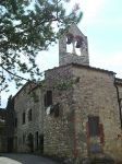
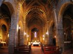
After taking, a bit further on, the road to the left and passing by Poggio San Polo, you descend to S. Polo in Rosso, a parish church recorded since 1070 in the maps of Coltibuono and conferred on the bishop of Fiesole in 1102 by Pasquale II. Although connected to the Abbey of Berardenga, it was under the protection of the Ricasoli family, who fortified it from the 14 C and made it an important strongpoint of the Florence defensive system. In 1478 it was occupied by the Sienese who, however, managed to keep it for only few years. The stone church has three naves. The left nave, which is raised up, has been crenellated and its vaults are covered in fourteenth-century frescoes. Next to the church, the fortified complex has several embrasures and the remains of machicolations. It also has two round towers at the corners, with scarp walls. |
|

|
A bit further on, from the same side, a short road leads to Galenda, a small village which is recorded in the maps of Coltibuono from the end of the 11 C and that preserves a beautiful stone tower with an arched door and two arched windows, all of which are original.
Immediately after Galenda, the road begins to descend into the deep valley of the Filicaie and, from the bottom, it climbs steeply on the left valley wall, passing by San Giusto in Salcio, an old parish church first mentioned in 1020. You then arrive in Le Selve, a settlement in a wonderful position on the peak of a precipitous hill. The church of San Martino located there was noted in the 13 C and preserves a truncated tower and another stone building with numerous original arched apertures. |
|

|
| Brown Itinerary | - Pieve di Spaltenna, Vertine, Uliveta, S. Donato in Perano, Vistarenni | | Red Itinerary | - Tornano, Morelline, Cacchiano, Monte Lodoli | | - Gaiole, Barbischio, Capannelle, Cancelli, Castello di Montegrossi, Badia a Coltibuono | | Violet Itinerary | - Vertine, Meleto, Rietine, Castagnoli, Starda, Monte Luco della Beraredenga, Montecastelli | | Orange Itinerary | - Campi, San Sano, Monteluco di Lecchi, San Polo in Rosso, Galenda, Le Selve | | Blue Itinerary | - San Giusto a Rentennano (alle Monache), Lucignano, La Torricella, Castello di Brolio |
|
|

|
|
|

|

|

|

|

|

|

|

|

|

|

|

|

|

|

|

|

|

|

|

|

|

|

|
|
